×You cannot access this repository.
Acamoz
-

Actividades agrícolas e de biomassa
Abstract : Mapeamento das actividades de apoio a producçao agrícola e a producçao de carvão desenvolvidas no...
Projection : EPSG:32737
Bounding Box : 260617.58421656, 8035244.3207668, 663383.14851748, 8300016.7334936
Actividades agrícolas e de biomassa
Load the map
View metadata
- Illustration
- Title
- Actividades agrícolas e de biomassa
- Abstract
- Mapeamento das actividades de apoio a producçao agrícola e a producçao de carvão desenvolvidas no âmbito do projecto MozBio Gilé em redor da Reserva Nacional do Gilé
- Projection
- EPSG:32737
- Bounding Box
- 260617.58421656, 8035244.3207668, 663383.14851748, 8300016.7334936
- Web Map Service
- WMS Url
- WMTS Url
-
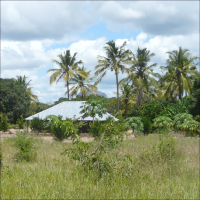
Pressão demografica
Abstract : A pressão demografica sobre os recursos naturais em redor da Reserva Nacional do Gilé
Projection : EPSG:32737
Bounding Box : 365664.94908719, 8121854.0823843, 514781.43645, 8210491.9944004
Pressão demografica
Load the map
View metadata
- Illustration
- Title
- Pressão demografica
- Abstract
- A pressão demografica sobre os recursos naturais em redor da Reserva Nacional do Gilé
- Projection
- EPSG:32737
- Bounding Box
- 365664.94908719, 8121854.0823843, 514781.43645, 8210491.9944004
- Web Map Service
- WMS Url
- WMTS Url
FORECO
-

GEOPORTAIL_FORECO_version_test_Mali
Abstract :
Projection : EPSG:3857
Bounding Box : -830577.26799441, 1397984.4110621, -495823.32241031, 1602449.2310628
GEOPORTAIL_FORECO_version_test_Mali
Load the map
View metadata
- Illustration
- Title
- GEOPORTAIL_FORECO_version_test_Mali
- Abstract
-
- Projection
- EPSG:3857
- Bounding Box
- -830577.26799441, 1397984.4110621, -495823.32241031, 1602449.2310628
- Web Map Service
- WMS Url
- WMTS Url
Namuli
-
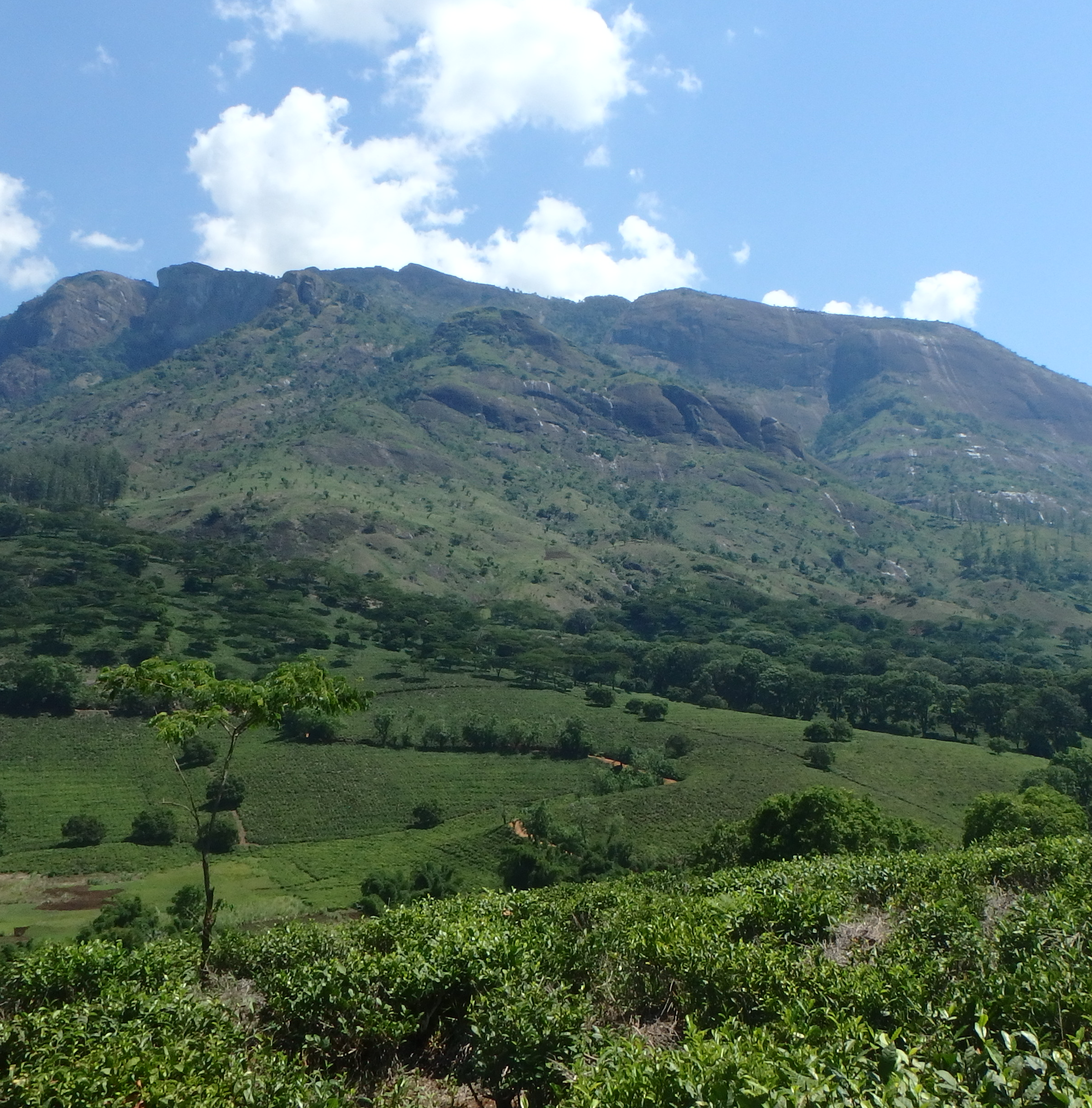
Mount Namuli
Abstract :
Projection : EPSG:32737
Bounding Box : 268440.54582651, 8281608.5977464, 321960.81618895, 8313502.9449101
Mount Namuli
Load the map
View metadata
- Illustration
- Title
- Mount Namuli
- Abstract
-
- Projection
- EPSG:32737
- Bounding Box
- 268440.54582651, 8281608.5977464, 321960.81618895, 8313502.9449101
- Web Map Service
- WMS Url
- WMTS Url
PapBio
-
PAPBIO_GEOPORTAIL
Abstract : L’objectif général est de “Promouvoir un développement économique endogène, inclusif et durable...
Projection : EPSG:32630
Bounding Box : 276110.25228738, 893860.30437033, 515392.9489024, 1040054.4454899
PAPBIO_GEOPORTAIL
Load the map
View metadata
- Illustration
- Title
- PAPBIO_GEOPORTAIL
- Abstract
- L’objectif général est de “Promouvoir un développement économique endogène, inclusif et durable des zones rurales périphériques (ex-projet GEPRENAF) du Parc National de la Comoé”. Trois grands résultats sont visés:
Ce géoportail fait partie intégrante du système de suivi-évaluation du Projet d'Appui à la Préservation de la Biodiversité de la périphérie du Parc National de la Comoé (PAPBIO Comoé). Il affiche tous les résultats spatialisables notamment les sites sur lesquelles se feront les appuis agricoles, les limites des territoires villageois, les couloirs de transhumances etc.
- Projection
- EPSG:32630
- Bounding Box
- 276110.25228738, 893860.30437033, 515392.9489024, 1040054.4454899
- Web Map Service
- WMS Url
- WMTS Url
PRM
-

PROJET REDD+ DE LA ME
Abstract :
Projection : EPSG:32630
Bounding Box : 234783.92082209, 580029.4135357, 483639.50190625, 733378.25809567
PROJET REDD+ DE LA ME
Load the map
View metadata
- Illustration
- Title
- PROJET REDD+ DE LA ME
- Abstract
-
- Projection
- EPSG:32630
- Bounding Box
- 234783.92082209, 580029.4135357, 483639.50190625, 733378.25809567
- Web Map Service
- WMS Url
- WMTS Url
-

Toutes les couches
Abstract :
Projection : EPSG:32630
Bounding Box : 266320.50503581, 541249.33168396, 549096.72538664, 792668.74837951
Toutes les couches
Load the map
View metadata
- Illustration
- Title
- Toutes les couches
- Abstract
-
- Projection
- EPSG:32630
- Bounding Box
- 266320.50503581, 541249.33168396, 549096.72538664, 792668.74837951
- Web Map Service
- WMS Url
- WMTS Url
Ribaue
-
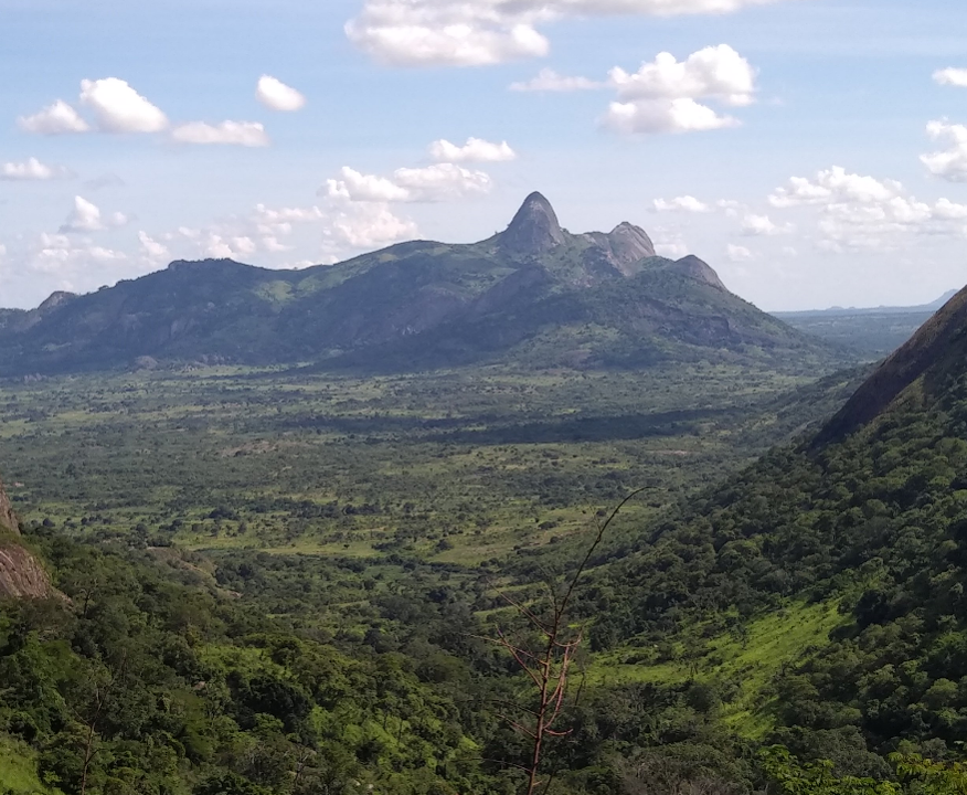
Ribaue mountains
Abstract :
Projection : EPSG:3857
Bounding Box : 4246494.9417462, -1684795.4337076, 4277716.7416815, -1666189.4192113
Ribaue mountains
Load the map
View metadata
- Illustration
- Title
- Ribaue mountains
- Abstract
-
- Projection
- EPSG:3857
- Bounding Box
- 4246494.9417462, -1684795.4337076, 4277716.7416815, -1666189.4192113
- Web Map Service
- WMS Url
- WMTS Url
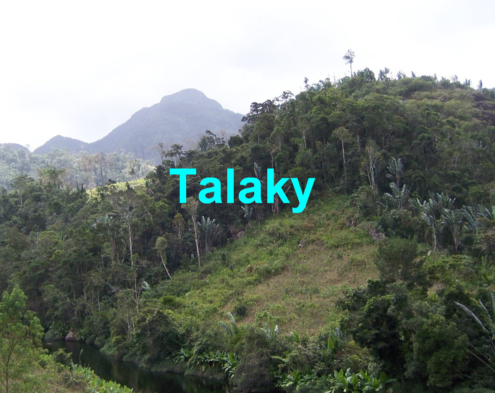
Talaky
-

Géoportail du projet Talaky
Abstract : Bienvenu sur le géoportail Géo Talaky.
Projection : EPSG:3857
Bounding Box : 4984192.4224427, -2881108.9904198, 5458047.1246394, -2620352.3029202
Géoportail du projet Talaky
Load the map
View metadata
- Illustration
- Title
- Géoportail du projet Talaky
- Abstract
- Bienvenu sur le géoportail Géo Talaky.
- Projection
- EPSG:3857
- Bounding Box
- 4984192.4224427, -2881108.9904198, 5458047.1246394, -2620352.3029202
- Web Map Service
- WMS Url
- WMTS Url
-
Géo-portail Talaky
Abstract :
Projection : EPSG:32738
Bounding Box : 635484.38415476, 7275410.6215998, 782261.44896714, 7359354.3567672
Géo-portail Talaky
Load the map
View metadata
- Illustration
- Title
- Géo-portail Talaky
- Abstract
-
- Projection
- EPSG:32738
- Bounding Box
- 635484.38415476, 7275410.6215998, 782261.44896714, 7359354.3567672
- Web Map Service
- WMS Url
- WMTS Url
Wakanda
-
Geoportail Wakanda
Abstract :
Projection : EPSG:4326
Bounding Box : -2.1156362550552, 11.030278044922, -0.37510370803394, 11.979964505347
Geoportail Wakanda
Load the map
View metadata
- Illustration
- Title
- Geoportail Wakanda
- Abstract
-
- Projection
- EPSG:4326
- Bounding Box
- -2.1156362550552, 11.030278044922, -0.37510370803394, 11.979964505347
- Web Map Service
- WMS Url
- WMTS Url